Menu

Thin-Layer Placement

Primary Menu

Skip to content
  • Welcome
  • What is TLP?
  • Resources
  • Case Studies
  • Gallery
  • Projects
  • Map Portal
  • List Server
  • Points of Contact
Search

Portfolio Category: Oregon

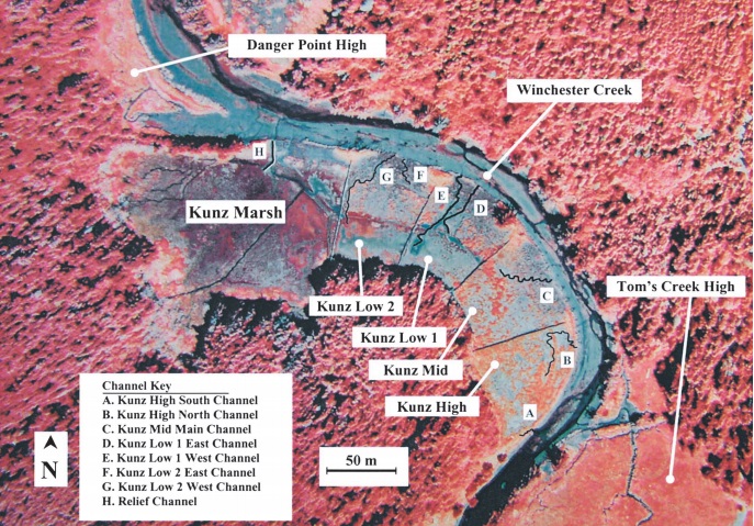
False-color aerial image of Kunz Marsh showing labeled monitoring sites, including Kunz High, Mid, Low 1 and Low 2, plus nearby Danger Point High and Tom’s Creek High. Lettered channels A–H and Winchester Creek are identified, with a north arrow and 50-meter scale.

South Slough National Estuarine Research Reserve

Project Sheet Location: Cooks County, Charleston, OR, US Year: 1996 Project Type(s): Habitat restoration Project Description: Five acres in the South Slough National Estuarine Research Read More …

Thin-Layer Placement| 2026 All Rights Reserved | Environmental Laboratory | Engineer Research & Development Center
  • Welcome
  • What is TLP?
  • Resources
  • Case Studies
  • Gallery
  • Projects
  • Map Portal
  • List Server
  • Points of Contact